Find
A list sorted by distance takes you from the whole picture to a single aircraft. Hide ground traffic or pin a plane to highlight it within the area.
SKYGLANCE · WEAR OS
PERSONAL PROTOTYPE / 0.5
SkyGlance brings air traffic to your Wear OS watch. Explore nearby aircraft on a radar, orient yourself with the compass and discover their route when available.
Explore the radar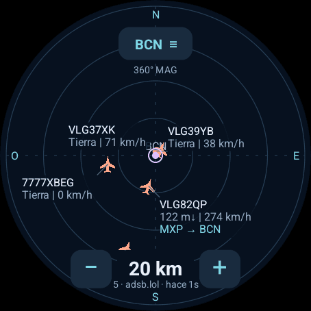
01 / By the runway, or anywhere else
Start at Barcelona–El Prat without granting location access. You can also use GPS, pick one of eleven airports or enter your own coordinates. The radar turns with you while labels stay upright; you can also keep north fixed.
A list sorted by distance takes you from the whole picture to a single aircraft. Hide ground traffic or pin a plane to highlight it within the area.
Choose 2, 5, 10, 20, 50 or 100 km with the controls or crown. From the immediate runway surroundings to more distant traffic.
Open an aircraft to see registration, type, altitude and speed. Departure and arrival airports appear when a compatible published route is available.
02 / Inside the watch
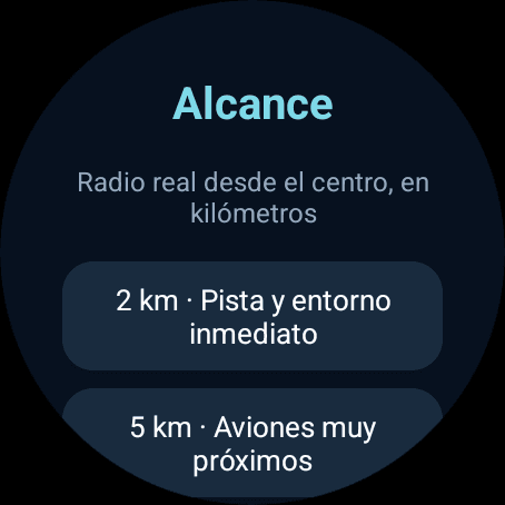
Six physical ranges in kilometres, with an explanation for each.
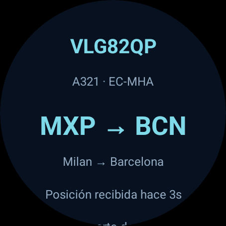
The detail screen brings together aircraft data and the available route. Routes may be missing or out of date.
03 / A work in progress
A personal prototype written in Kotlin, using native Android views and a Canvas radar. It runs independently: the watch needs Internet access, but no account, API keys or phone app. It is not available in an app store yet.
Preferences stay on the watch; traffic and routes stay in memory. adsb.lol receives your IP address and the selected centre. Route providers receive your IP address and the callsign. A manual centre lets you explore without GPS permission.
Coverage depends on the providers: an empty radar does not mean an empty sky. Routes load progressively and are not operational confirmation. There is no global search, history or tracking outside the selected area.
Positions: adsb.lol · Data under ODbL 1.0
Routes: VRS / adsb.lol · adsbdb
For aviation enthusiasts. Do not use for air navigation.
Get in touch to learn more or share an idea.